Report on Laguna del Maule (Chile) — 17 February-23 February 2021
Smithsonian Institution / US Geological Survey
Weekly Volcanic Activity Report, 17 February-23 February 2021
Managing Editor: Sally Sennert.
Please cite this report as:
Global Volcanism Program, 2021. Report on Laguna del Maule (Chile) (Sennert, S, ed.). Weekly Volcanic Activity Report, 17 February-23 February 2021. Smithsonian Institution and US Geological Survey.
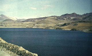
Laguna del Maule
Chile
36.058°S, 70.492°W; summit elev. 2162 m
All times are local (unless otherwise noted)
SERNAGEOMIN reported that during 1-16 February the seismic network at Laguna del Maule recorded a total of 533 volcano-tectonic earthquakes. Two earthquake swarms were recorded during 15-16 February; the largest events were local magnitude 3.1, and were located 9.1 and 8.8 km SW of the lake at a depth of 1.9 km. The epicenters were near the area producing anomalous carbon dioxide emissions. Swarms were recorded in June and December 2020, and January and February 2021, with the largest events occurring during the most recent swarm.
The highest rate of inflation during the previous 30 days was 2.3 cm/month, recorded at a station closest to the center of deformation. The highest horizontal displacement was an estimated 1.4 cm/month from a station just SW of the center. InSAR data mostly showed agreement in the magnitude and distribution of the ground-based deformation data. Overall, the deformation rates were higher than maximum averages. On 22 February the Alert Level was raised to Yellow, the second lowest level on a four-color scale. ONEMI declared a Yellow Alert for San Clemente and recommended restricted access within a radius of 2 km from the center of elevated carbon dioxide emissions.
Geological Summary. The Laguna del Maule volcanic complex includes a 15 x 25 km caldera with a cluster of small stratovolcanoes, lava domes, and pyroclastic cones of Pleistocene-to-Holocene age. The caldera lies mostly on the Chilean side of the border, but partially extends into Argentina. Fourteen Pleistocene basaltic lava flows were erupted down the upper part of the Maule river valley. A cluster of Pleistocene cinder cones was constructed on the NW side of Maule lake in the northern part of the caldera. The latest activity produced an explosion crater on the E side of the lake and a series of Holocene rhyolitic lava domes and blocky lava flows that surround it.
Sources: Servicio Nacional de Geología y Minería (SERNAGEOMIN), Oficina Nacional de Emergencia-Ministerio del Interior (ONEMI)