
Smithsonian Institution / US Geological Survey
Weekly Volcanic Activity Report, 5 July-11 July 2023
Managing Editor: Sally Sennert
Please cite this report as:
Global Volcanism Program, 2023. Report on Kuchinoerabujima (Japan) (Sennert, S, ed.). Weekly Volcanic Activity Report, 5 July-11 July 2023. Smithsonian Institution and US Geological Survey. https://volcano.si.edu/showreport.cfm?gvpvar=GVP.WVAR20230705-282050
JMA reported that shallow volcanic earthquakes at Kuchinoerabujima had been occurring frequently starting in late June with most epicenters located near Furudake Crater, and some near Shindake Crater (just N of Furudake). Both the number and magnitude of the volcanic earthquakes increased on 9 June and remained elevated through 12 July; there were 151 events on 9 July, 319 on 10 July, 276 on 11 July, and 172 by 1500 on 12 July. The public was previously warned that ejected blocks and pyroclastic flows may affect areas within 2 km of Shindake, and at 1600 on 10 June the public was also warned to stay 2 km away from Furudake. The Alert Level remained at 3 (on a scale of 1-5).
Source: Japan Meteorological Agency (JMA)
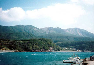
Geological Summary. A group of young stratovolcanoes forms the eastern end of the irregularly shaped island of Kuchinoerabujima in the northern Ryukyu Islands, 15 km W of Yakushima. The Furudake, Shindake, and Noikeyama cones were erupted from south to north, respectively, forming a composite cone with multiple craters. All historical eruptions have occurred from Shindake, although a lava flow from the S flank of Furudake that reached the coast has a very fresh morphology. Frequent explosive eruptions have taken place from Shindake since 1840; the largest of these was in December 1933. Several villages on the 4 x 12 km island are located within a few kilometers of the active crater and have suffered damage from eruptions.


 Kuchinoerabujima