
Smithsonian Institution / US Geological Survey
Weekly Volcanic Activity Report, 19 July-25 July 2023
Managing Editor: Sally Sennert
Please cite this report as:
Global Volcanism Program, 2023. Report on Piton de la Fournaise (France) (Sennert, S, ed.). Weekly Volcanic Activity Report, 19 July-25 July 2023. Smithsonian Institution and US Geological Survey. https://volcano.si.edu/showreport.cfm?gvpvar=GVP.WVAR20230719-233020
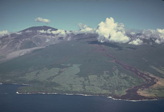
OVPF reported that the eruption that began on 2 July at Piton de la Fournaise was ongoing during 19-25 July, though weather conditions often obscured views. The active cone was about 30 m tall and located on the upper part of Grandes Pentes, SE of Enclos Fouqué, at approximately 1,720 m a.s.l. Volcano-tectonic earthquake events fluctuated throughout the week but remained low relative to the onset of the eruption. The lava lake in the cone was low and lava was occasionally ejected above the rim. Lava was mainly transported through lava tubes and was not visible immediately near the cone. The longest part of the flow did not advance and remained stalled 1.8 km from the road, but the flow field continued to widen and thicken. Breakouts were visible in areas between 1,300 m and 1,500 m elevation. The total volume of lava effused since the beginning of the eruption was an estimated 8.5 ± 3 million cubic meters by 22 July.
Source: Observatoire Volcanologique du Piton de la Fournaise (OVPF)
Geological Summary. Piton de la Fournaise is a massive basaltic shield volcano on the French island of Réunion in the western Indian Ocean. Much of its more than 530,000-year history overlapped with eruptions of the deeply dissected Piton des Neiges shield volcano to the NW. Three scarps formed at about 250,000, 65,000, and less than 5,000 years ago by progressive eastward slumping, leaving large embayments open to the E and SE. Numerous pyroclastic cones are present on the floor of the scarps and their outer flanks. Most recorded eruptions have originated from the summit and flanks of Dolomieu, a 400-m-high lava shield that has grown within the youngest scarp, which is about 9 km wide and about 13 km from the western wall to the ocean on the E. More than 150 eruptions, most of which have produced fluid basaltic lava flows, have occurred since the 17th century. Eruptions in 1708, 1774, 1776, 1800, 1977, and 1986 originated from fissures outside the scarps.


 Piton de la Fournaise