
Smithsonian Institution / US Geological Survey
Weekly Volcanic Activity Report, 13 November-19 November 2024
Managing Editor: Sally Sennert
Please cite this report as:
Global Volcanism Program, 2024. Report on Ibu (Indonesia) (Sennert, S, ed.). Weekly Volcanic Activity Report, 13 November-19 November 2024. Smithsonian Institution and US Geological Survey. https://volcano.si.edu/showreport.cfm?gvpvar=GVP.WVAR20241113-268030
The Pusat Vulkanologi dan Mitigasi Bencana Geologi (PVMBG) reported that activity at Ibu continued during 13-19 November. Daily gray or white-and-gray ash plumes that were often dense rose as high as 3 km above the summit and drifted in multiple directions. Some webcam images posted with the reports showed incandescence visible above the crater rim. The Alert Level remained at 3 (the second highest level on a four-level scale) and the public was advised to stay 4 km away from the active crater and 5 km away from the N crater wall opening.
Source: Pusat Vulkanologi dan Mitigasi Bencana Geologi (PVMBG, also known as CVGHM)
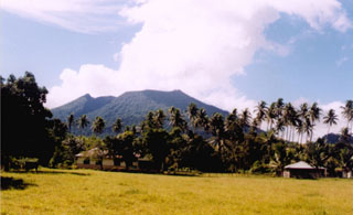
Geological Summary. The truncated summit of Gunung Ibu stratovolcano along the NW coast of Halmahera Island has large nested summit craters. The inner crater, 1 km wide and 400 m deep, has contained several small crater lakes. The 1.2-km-wide outer crater is breached on the N, creating a steep-walled valley. A large cone grew ENE of the summit, and a smaller one to the WSW has fed a lava flow down the W flank. A group of maars is located below the N and W flanks. The first observed and recorded eruption was a small explosion from the summit crater in 1911. Eruptive activity began again in December 1998, producing a lava dome that eventually covered much of the floor of the inner summit crater along with ongoing explosive ash emissions.


 Ibu
Ibu