Keyword Collections | Keyword "oxidation"
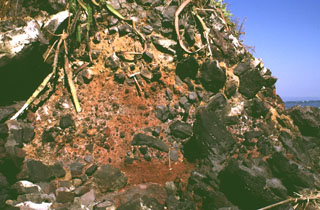 Large clasts in an oxidized scoria matrix of the Acajutla debris avalanche deposit are exposed at the Pacific Ocean coastline more than 40 km from Santa Ana volcano. Clasts with a jigsaw fracture pattern can be seen at the top of the photo and clasts at least 6 m in diameter are nearby. Note the rock hammer in the center for scale.
Photo by Lee Siebert, 1999 (Smithsonian Institution).
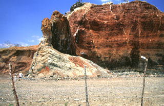 Volcanic dikes of varying orientations were emplaced into oxidized red scoria in a quarried scoria cone near the village of Agua Blanca. Several generations of thin dikes are visible (note people at the lower left for scale). The larger dike supporting the pinnacle near the center is oriented north-south, parallel to the direction of faults defining the Ipala graben.
Photo by Giuseppina Kysar, 1999 (Smithsonian Institution).
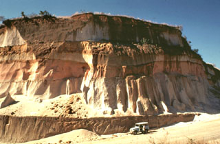 Thick units of the 84,000-year-old Los Chocoyos Ash are exposed south of Guatemala City, more than 100 km from its source at Atitlán caldera. Three units are visible here. The pinkish unit across the center of is the oxidized top of the pyroclastic flow deposit. The bottom two white units are the top and bottom halves of the deposit. The two fall deposits above the Los Chocoyos Ash are unit E from Amatitlán caldera and the younger unit C from Volcán de Agua.
Photo by Bill Rose, 1978 (Michigan Technological University).
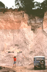 A geologist examines an outcrop of the 84,000-year-old Los Chocoyos Ash near Patzún, about 10 km E of Lake Atitlán. Note the charred log above his head. This pyroclastic flow unit of the Los Chocoyos deposit is up to 200 m thick and is exposed over an area of about 2,000 km2. Individual flow units of the voluminous ignimbrite are sometimes more than 100 m thick. The upper part of the deposit is characteristically salmon-pink in color as a result of oxidation of the cooling flow.
Photo by Bill Rose, 1980 (Michigan Technological University).
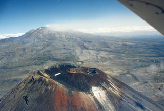 The Ngāuruhoe summit of the Tongariro volcanic complex is in the foreground, while in the background is a weak plume produced during the 1995-96 Ruapehu eruption, dispersing to the SW. The scoria cone within the Ngāuruhoe crater largely formed during the 1954-55 eruption and produced lava flows down the NW to W flanks.
Photo by John A Krippner, 1995-1996.


