Image GVP-01604
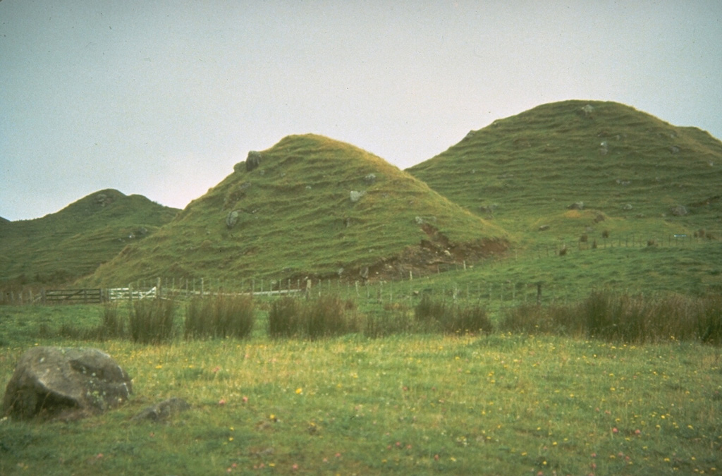
Grass-covered conical hills dot the plains around Mount Taranaki on New Zealand's North Island. Small hills such as these, often located in lowland areas well beyond the flanks of a volcano, were once thought to be scoria cones or small secondary vents produced by explosions when a lava flow passed over a body of water. They are now recognized to be hummocks of massive debris avalanches produced by volcanic landslides or flank collapse. Debris avalanche deposits originating from repetitive collapse surround the volcano to distances of about 40 km.
Photo by Don Swanson, 1984 (U.S. Geological Survey).
![]() This image is made available as a Public Domain Work, but proper attribution is appreciated.
This image is made available as a Public Domain Work, but proper attribution is appreciated.
Galleries: Debris Avalanches / Landslides
Keywords: debris avalanche deposit | deposit | hummock
Taranaki