Image GVP-02691
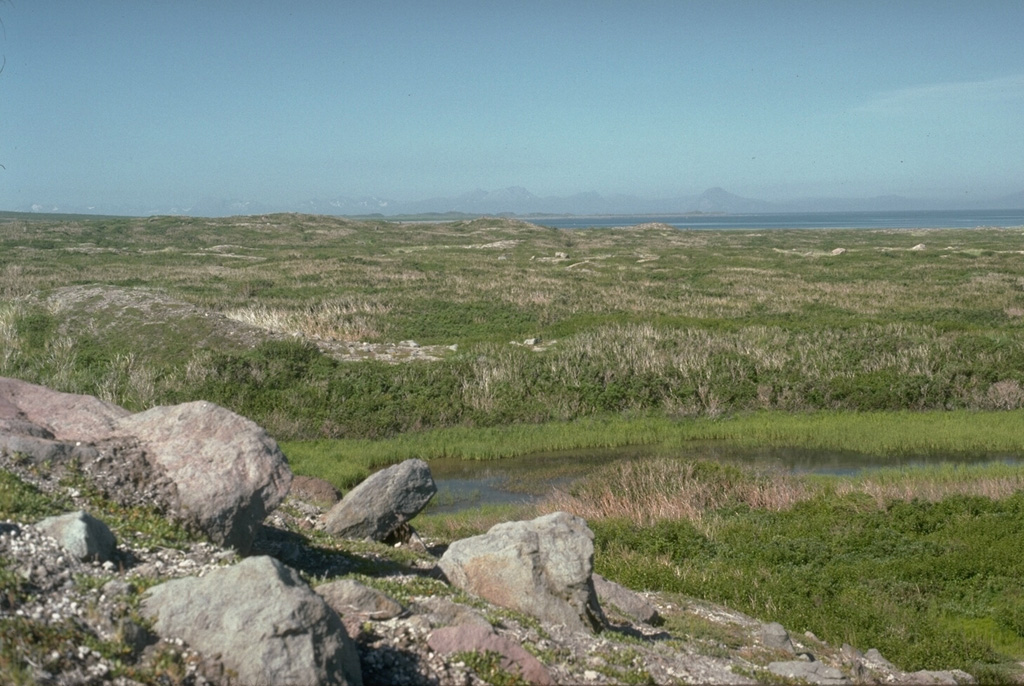
The vegetated terrain seen here is the surface of the Rocky Point debris avalanche deposit, produced by collapse of the summit of Augustine about 250-450 years ago. The avalanche traveled into Cook Inlet, visible at the upper left with the Chigmit Mountains in the background, for a distance of 8 km and extended the shoreline by 2 km.
Photo by Lee Siebert, 1990 (Smithsonian Institution).
![]() This image is made available under the Public Domain Dedication CC0 license, but proper attribution is appreciated.
This image is made available under the Public Domain Dedication CC0 license, but proper attribution is appreciated.
Galleries: Volcanic Outcrops | Debris Avalanches / Landslides
Keywords: debris avalanche deposit | deposit | outcrop | geology
Augustine