Image GVP-02813
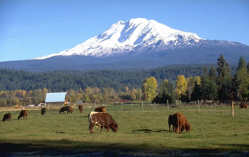
The farmlands of the Trout Lake valley SW of Mount Adams are underlain by a massive lahar produced by collapse of the upper SW flank of Adams about 6,000 years ago. Altered rocks up to several meters in diameter that originated from near the summit of the volcano littered the surface of the deposit, which covered 15 km2 of the Trout Lake lowland and reached as far as 60 km to the south. The source of the mudflow was a debris avalanche from the upper White Salmon glacier area, just left of the shadow beneath the summit.
Photo by Lee Siebert, 1995 (Smithsonian Institution).
![]() This image is made available under the Public Domain Dedication CC0 license, but proper attribution is appreciated.
This image is made available under the Public Domain Dedication CC0 license, but proper attribution is appreciated.
Keywords: stratovolcano
Adams