Image GVP-02978
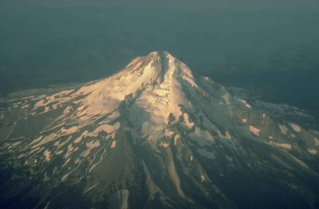
This aerial view from the NE shows Eliot Glacier descending the valley in the center, with glacial moraines at its base. During the late Pleistocene a major lahar from Mount Hood swept to the north across the Columbia River, temporarily filling it to a depth of 30 m.
Photo by Richard Waitt, 1983 (U.S. Geological Survey).
![]() This image is made available as a Public Domain Work, but proper attribution is appreciated.
This image is made available as a Public Domain Work, but proper attribution is appreciated.
Keywords: stratovolcano | erosion
Hood