Image GVP-03849
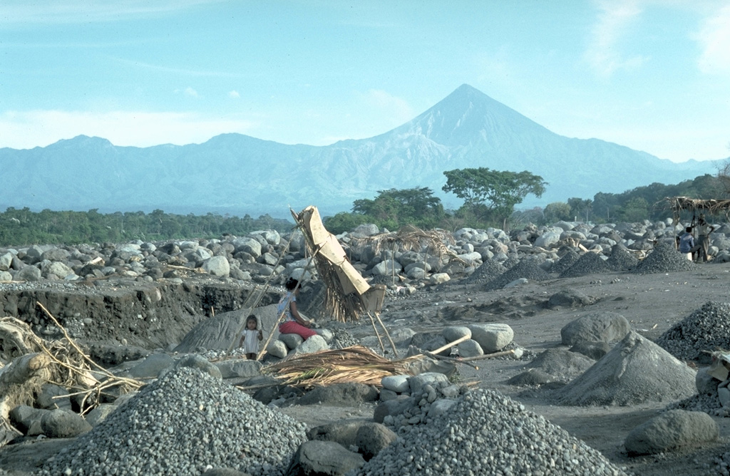
The debris from the Santiaguito lava dome (visible below and to the left of the summit of Santa María) severely impacts downslope river drainages. Frequent rainy season lahars descend the Río Samalá, seen here just south of the Pacific coastal highway. Major lahars on 28 August 1993 (three months prior to this photo) covered 200 m of the highway and filled the river channel to within 50 cm of the highway bridge. A small-scale construction aggregate operation can be seen in the foreground.
Photo by Lee Siebert, 1993 (Smithsonian Institution).
![]() This image is made available under the Public Domain Dedication CC0 license, but proper attribution is appreciated.
This image is made available under the Public Domain Dedication CC0 license, but proper attribution is appreciated.
Keywords: lava dome | environmental impact | deposit | lahar

Santa María