Image GVP-05506
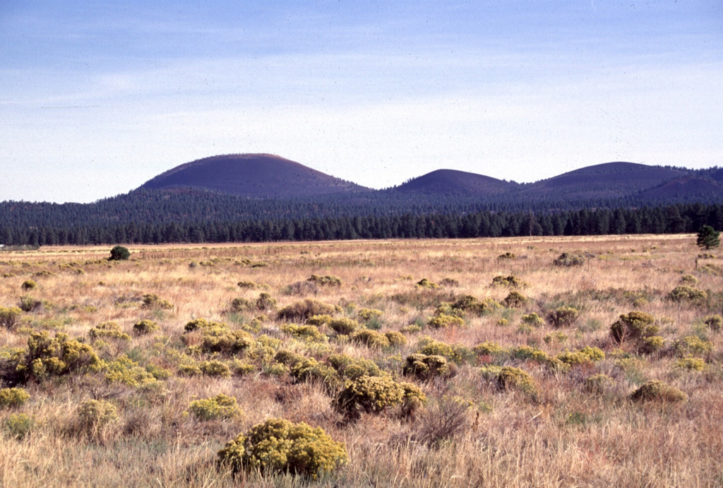
Sunset Crater (left) and adjacent cinder cones are seen here from the west across the meadows of Bonito Park. Sunset Crater and adjacent cones were erupted along a 10-km-long, NW-SE-trending line, with Sunset Crater being the NW-most vent. The Sunset Crater eruptions severly affected Sinagua Indians living in the area, who temporarily evacuated the region.
Photo by Lee Siebert, 1996 (Smithsonian Institution).
![]() This image is made available under the Public Domain Dedication CC0 license, but proper attribution is appreciated.
This image is made available under the Public Domain Dedication CC0 license, but proper attribution is appreciated.
San Francisco Volcanic Field