Image GVP-06377
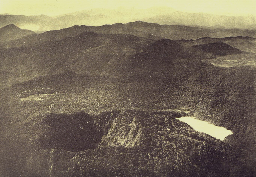
An aerial view from the NNW shows the two summit craters of Gunung Patuha volcano in the foreground. Steep-walled Taman Saat crater (left) is located NW of lake-filled Kawah Putih (right). The dashed circle at the middle left indicates an unvegetated area called the “Tugeslibde crater.”
Photo published in Taverne, 1926 "Vulkaanstudien op Java," (courtesy of Volcanological Survey of Indonesia).
![]() This image is made available under the Creative Commons BY-NC 4.0 license terms.
This image is made available under the Creative Commons BY-NC 4.0 license terms.
Keywords: crater
Patuha