Image GVP-08142
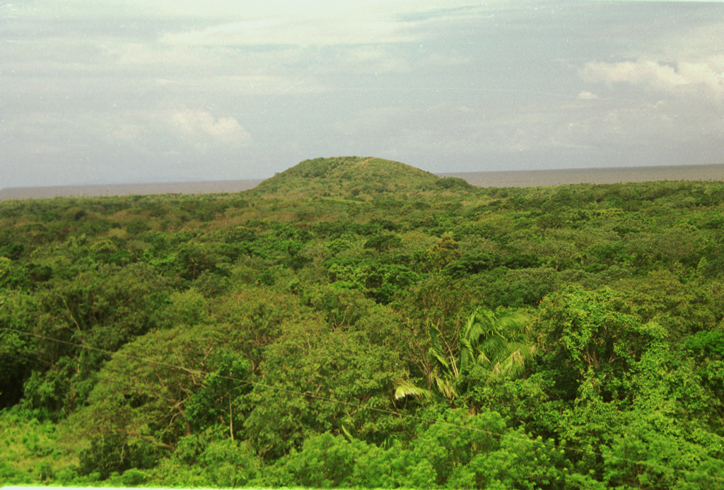
Pumpkin Hill, a small pyroclastic cone at the NE end of Utila Island, is seen here across a forest from Stuert Hill, the other pyroclastic cone on the eastern side of the island. The two cones lie about 2 km apart and were constructed over flat-lying terraces that cover much of the elongated, 3 x 11 km wide island. Alkaline olivine-basaltic lava flows erupted from the cones cover much of the eastern side of the island and underlie the forest in this photo. The Caribbean Sea lies in the background to the NE.
Photo by Rick Wunderman, 1999 (Smithsonian Institution).
![]() This image is made available under the Public Domain Dedication CC0 license, but proper attribution is appreciated.
This image is made available under the Public Domain Dedication CC0 license, but proper attribution is appreciated.
Utila Volcanic Center