Image GVP-10081
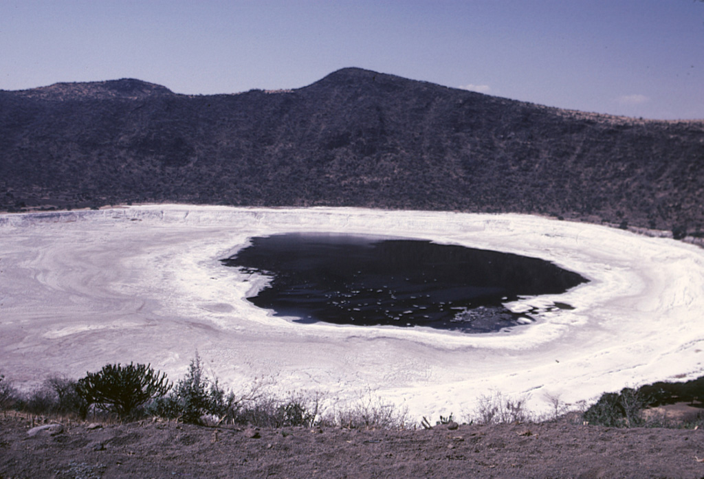
The Hoya Rincón de Parangüeo maar rises directly above the town of the same name located on the lower southern flank. A brackish lake of seasonally variable size partially fills the floor of the 2-km-wide maar, seen here from its southern rim. The high point on the northern rim rises 450 m above the crater floor. Rincón de Parangueo is part of the Valle de Santiago maar field on the NE side of the Michoacán-Guanajuato volcanic field and is about 7 km NW of the town of Valle de Santiago.
Photo by Jim Luhr, 2002 (Smithsonian Institution).
![]() This image is made available under the Public Domain Dedication CC0 license, but proper attribution is appreciated.
This image is made available under the Public Domain Dedication CC0 license, but proper attribution is appreciated.
Keywords: maar | crater | crater lake
Michoacán-Guanajuato