Image GVP-10185
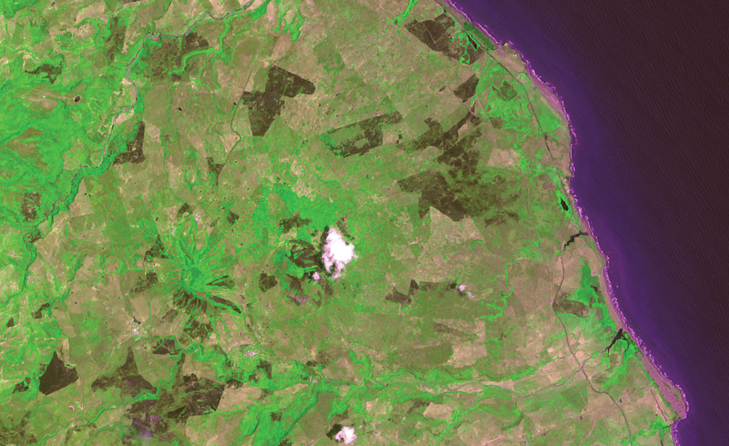
Pyroclastic cones capping the Los Atlixcos shield volcano lie left of the white atmospheric cloud at the center of the image. Lava flows from the shield volcano traveled north and east to reach the coast of the Gulf of Mexico along a broad front covering most of the coast in this view, which covers approximately 10 km in a N-S direction. The west-flowing Río El Tecuán at the bottom of the image defines the southern margin of the lava shield, while the NE-trending Río Santa Ana at the upper left marks the NE margin.
ASTER satellite image, 2002 (National Aeronautical and Space Administration, processed by Doug Edmonds).
![]() This image is made available under the Creative Commons BY-NC 4.0 license terms.
This image is made available under the Creative Commons BY-NC 4.0 license terms.
Los Atlixcos