Image GVP-10332
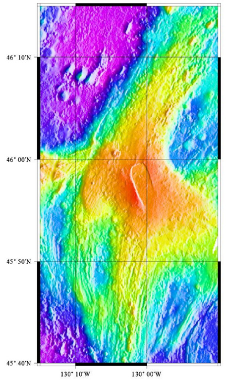
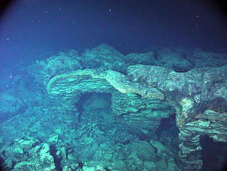
Axial volcano lies along the central Juan de Fuca Ridge crest about 480 km W of the Oregon coast. The summit reaches about 1.4 km below the ocean surface and is marked by a 3 x 8 km caldera (center). The caldera opens to the SE and has caldera walls up to 150 m high. Hydrothermal vents colonized with biological communities are located near the caldera boundary or along rift zones to the NE and S. In 1998 a lava flow was erupted from a fissure at the southern end of the caldera.
Image courtesy of National Oceanic and Atmospheric Administration (http://www.pmel.noaa.gov/vents/home.html).
![]() This image is made available as a Public Domain Work, but proper attribution is appreciated.
This image is made available as a Public Domain Work, but proper attribution is appreciated.
Keywords: submarine volcano | technology | bathymetry | remote sensing | DEM
Axial Seamount