Image GVP-10439
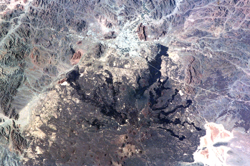
The northern part of Saudi Arabia's largest lava field, 20,000 km2 Harrat Rahat, is seen in this NASA International Space Station image (N to the top left). Harrat Rahat extends for 300 km S of the city of Madinah (Medina), the light-colored area at the top-center. Although basaltic scoria cones are more common, small shield volcanoes and lava domes are also present. The most well-known eruption took place in 1256 CE, when the large dark-colored flow seen extending to the upper right traveled 23 km to within 4 km of Madinah.
NASA International Space Station image ISS001-344-27, 2001 (http://eol.jsc.nasa.gov/).
![]() This image is made available as a Public Domain Work, but proper attribution is appreciated.
This image is made available as a Public Domain Work, but proper attribution is appreciated.
Galleries: Volcanic Fields
Keywords: volcanic field | lava flow | remote sensing

Harrat Rahat