Image GVP-11494
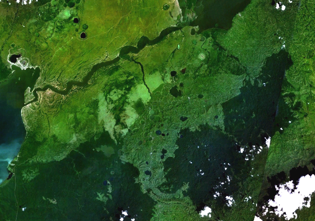
Maars of the Bunyaruguru volcanic field, also known as the Kichwambe volcanic field, blanket the center of this NASA Landsat image (with N to the top) of the E side of the Western Rift Valley. The Bunyaruguru field, lying south of the river channel connecting Lake Edward (left-center) and Lake George (top right), contains more than 130 craters, 27 of which contain lakes with water ranging from fresh to saline. Maars of the Katwe-Kikorongo volcanic field lie across the river channel at the upper left.
NASA Landsat 7 image (worldwind.arc.nasa.gov)
![]() This image is made available as a Public Domain Work, but proper attribution is appreciated.
This image is made available as a Public Domain Work, but proper attribution is appreciated.
Galleries: Volcanic Fields
Keywords: remote sensing | crater lake | volcanic field
Bunyaruguru Volcanic Field