Image GVP-12105
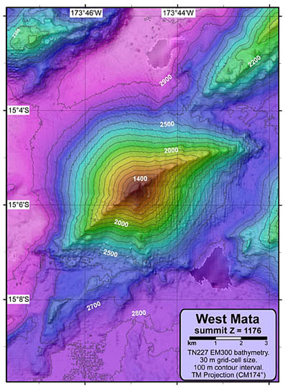
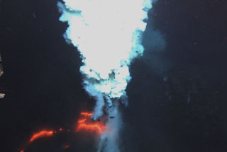
A NOAA Vents Program bathymetric map shows West Mata volcano that rises about 1,500 m from the sea floor at the N end of the Tonga arc. Submarine eruptions were detected in 2008 and 2009 from two vents. The lower flanks of East Mata volcano are visible at the middle right.
Courtesy of NSF and NOAA Ocean Exploration Program, 2009.
![]() This image is made available as a Public Domain Work, but proper attribution is appreciated.
This image is made available as a Public Domain Work, but proper attribution is appreciated.
Keywords: submarine volcano | stratovolcano | remote sensing | technology | DEM | map | bathymetry
West Mata