Image GVP-12220
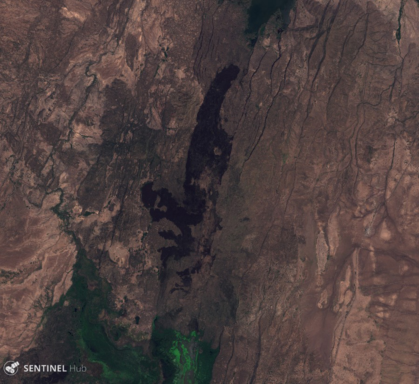
The dark rock down the center of this 26 October 2019 Sentinel-2 satellite image is a series of lava flows erupted from Hertali, located at the southern end of the Awash Plain and about 50 km NNE of Dofan volcano (N is at the top; this image is approximately 32 km across). Numerous NNE-SSW-trending faults of the Ethiopian Rift are visible along both sides of the flow.
Satellite image courtesy of Copernicus Sentinel Data, 2019.
![]() This image is made available under the Creative Commons BY-SA 4.0 license terms.
This image is made available under the Creative Commons BY-SA 4.0 license terms.
Keywords: lava flow
Hertali