Image GVP-12252
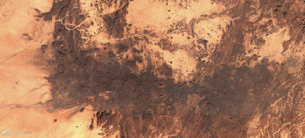
The E-W-trending Tahalra Volcanic Field within the Hoggar Province of southern Algeria covers an area of around 1,800 km2, seen here in this 3 December 2019 Sentinel-2 satellite image (N is at the top). Numerous cones and craters are visible across the image.
Satellite image courtesy of Copernicus Sentinel Data, 2019.
![]() This image is made available under the Creative Commons BY-SA 4.0 license terms.
This image is made available under the Creative Commons BY-SA 4.0 license terms.
Keywords: volcanic field | scoria cone
Tahalra Volcanic Field