Image GVP-12257
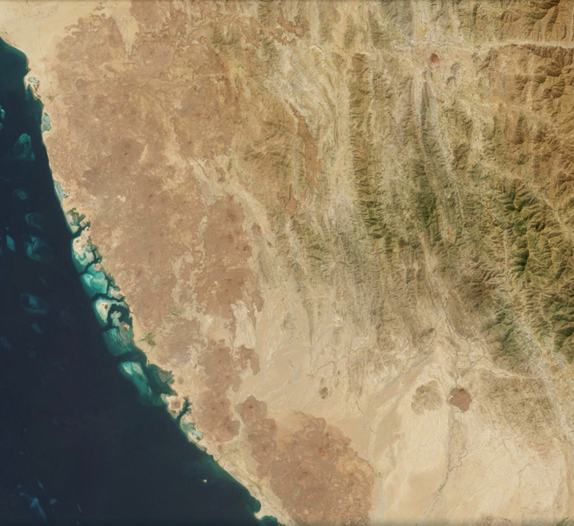
Around 200 identified scoria cones have formed throughout the 1,800 km2 Harrat al Birk volcanic field, seen along the Red Sea coast of Saudi Arabia in this 20 October 2020 Sentinel-2 satellite image (N is at the top; this image is approximately 93 km across). In the center of the top boundary of this image is two recent cones and lava flows, Jabal Ba’a and Jabal al Qishr, in the Asir mountains.
Satellite image courtesy of Copernicus Sentinel Data, 2019.
![]() This image is made available under the Creative Commons BY-SA 4.0 license terms.
This image is made available under the Creative Commons BY-SA 4.0 license terms.
Keywords: volcanic field | remote sensing
Harrat al Birk