Image GVP-12299

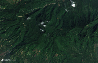
This 1 February 2019 Sentinel-2 satellite image (N is at the top) shows part of southern end of the 35-km-long volcanic island of Biliran, located across the narrow Biliran Strait from the northern tip of Leyte Island (left). Lava domes, craters, and geothermal areas have formed around the island.
Satellite image courtesy of Copernicus Sentinel Data, 2019.
![]() This image is made available under the Creative Commons BY-SA 4.0 license terms.
This image is made available under the Creative Commons BY-SA 4.0 license terms.
Biliran