Image GVP-12403
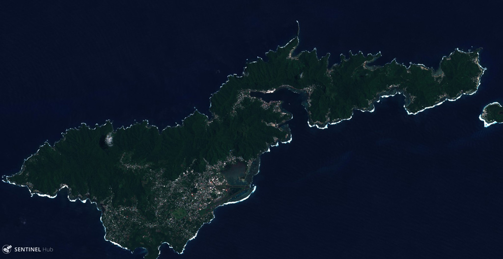
Tutuila Island is in the center of the Samoan Islands, shown in this 3 March 2019 Sentinel-2 satellite image (N is at the top; this image is approximately 44 km across). The extensively eroded island has multiple eruptive centers that have produced domes, cones, craters, and calderas.
Satellite image courtesy of Copernicus Sentinel Data, 2019.
![]() This image is made available under the Creative Commons BY-SA 4.0 license terms.
This image is made available under the Creative Commons BY-SA 4.0 license terms.
Keywords: island volcano
Tutuila