Image GVP-12418
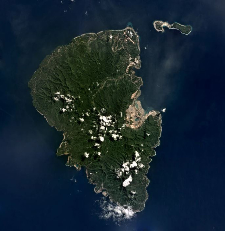
The 192 km2 Lihir Island, approximately 22 km long in the N-S direction, is shown in this July 2019 Planet Labs satellite image monthly mosaic (N is at the top). The Ladolam gold deposit open pit mine is visible on the E coast within the remains of Luise volcano that has undergone flank collapse, resulting in a 1-km-long debris avalanche deposit offshore. After the collapse event the gold deposit accumulated from hydrothermal fluids.
Satellite image courtesy of Planet Labs Inc., 2019 (https://www.planet.com/).
Copyrighted image used with permission. All Rights Reserved. Contact photographer for any usage requests.
Lihir