Image GVP-12555
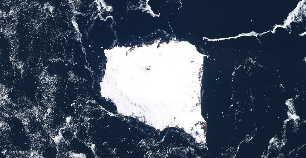
The glaciated 12 x 12 km Montagu Island in the South Sandwich Islands is shown in this 2 December 2019 Sentinel-2 satellite image (N is at the top). The highest point is Mount Belinda near the northern coastline with the dark crater apparent here, which appears to have formed within a 6-km-diameter, ice-filled caldera. The SE peninsula is Mount Oceanite.
Satellite image courtesy of Copernicus Sentinel Data, 2019.
![]() This image is made available under the Creative Commons BY-SA 4.0 license terms.
This image is made available under the Creative Commons BY-SA 4.0 license terms.
Keywords: island volcano
Montagu Island