Image GVP-12636
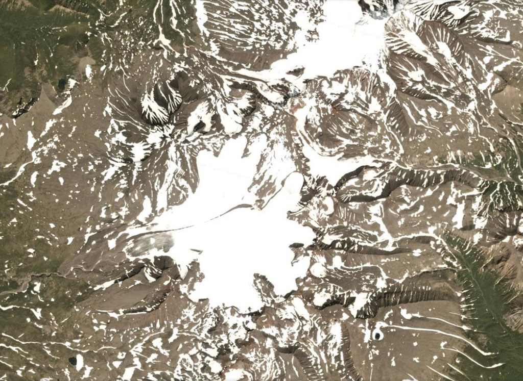
A glacier near the summit of Bely volcano flows down the western flank, shown in this 7 August 2020 PlanetScope satellite image (N is at the top; this image is approximately 21 km across). In relation to the glacier head, to the NW is the Bely cone, NE is Keveneytunup cone, NEE is the Lagerny cone, and SW is Sergeeva, all parts of the Bely complex. The smoother area to the SE with a small crater is Kaileney volcano.
Satellite image courtesy of Planet Labs Inc., 2020 (https://www.planet.com/).
Copyrighted image used with permission. All Rights Reserved. Contact photographer for any usage requests.
Bely