Report on Galeras (Colombia) — June 1996
Bulletin of the Global Volcanism Network, vol. 21, no. 6 (June 1996)
Managing Editor: Richard Wunderman.
Galeras (Colombia) Degassing and low seismic activity continue
Please cite this report as:
Global Volcanism Program, 1996. Report on Galeras (Colombia) (Wunderman, R., ed.). Bulletin of the Global Volcanism Network, 21:6. Smithsonian Institution. https://doi.org/10.5479/si.GVP.BGVN199606-351080
Galeras
Colombia
1.22°N, 77.37°W; summit elev. 4276 m
All times are local (unless otherwise noted)
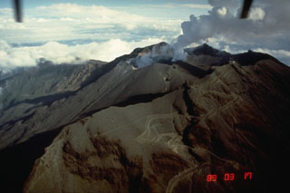
Seismicity during May and June remained low, similar to previous months, and was characterized by fracture events centered 2-8 km NNE of the main crater, generally at 5-10 km depths. Surface degassing was still concentrated in craters, and fumaroles were located in the W sector of the active cone, mainly at the Chavas and La Joya sites. Correlation spectrophotometer (COSPEC) data indicated that SO2 was emitted around the volcano at rates of <100 tons/day. The deformation network did not show significant changes.
On 1 May, a M 1.6 event was felt. Moreover, on 20 May, an M 3.7 event occurred 10 km SE of the volcano that was felt by inhabitants of Pasto and in the epicentral zone.
In June, the coda magnitudes for seismic events had M < 1.7. High-frequency events with M < 2.3 were located near Rio Bobo, ~15 km SW of Galeras, at depths <14 km. In addition, during June the seismicity interpreted as related to dynamic fluids remained low, and the seismic network recorded 35 long-period events.
Geological Summary. Galeras, a stratovolcano with a large breached caldera located immediately west of the city of Pasto, is one of Colombia's most frequently active volcanoes. The dominantly andesitic complex has been active for more than 1 million years, and two major caldera collapse eruptions took place during the late Pleistocene. Long-term extensive hydrothermal alteration has contributed to large-scale edifice collapse on at least three occasions, producing debris avalanches that swept to the west and left a large open caldera inside which the modern cone has been constructed. Major explosive eruptions since the mid-Holocene have produced widespread tephra deposits and pyroclastic flows that swept all but the southern flanks. A central cone slightly lower than the caldera rim has been the site of numerous small-to-moderate eruptions since the time of the Spanish conquistadors.
Information Contacts: Pablo Chamorro, INGEOMINAS Observatorio Vulcanologico y Sismologico de Pasto (OVP), A.A. 1795, San Juan de Pasto, Nariño, Colombia (URL: https://www2.sgc.gov.co/volcanes/index.html).

