Report on Cerro Hudson (Chile) — 26 October-1 November 2011
Smithsonian Institution / US Geological Survey
Weekly Volcanic Activity Report, 26 October-1 November 2011
Managing Editor: Sally Sennert.
Please cite this report as:
Global Volcanism Program, 2011. Report on Cerro Hudson (Chile) (Sennert, S, ed.). Weekly Volcanic Activity Report, 26 October-1 November 2011. Smithsonian Institution and US Geological Survey.
Cerro Hudson
Chile
45.9°S, 72.97°W; summit elev. 1905 m
All times are local (unless otherwise noted)
OVDAS-SERNAGEOMIN reported three new craters at Cerro Hudson following increased seismicity that was detected during 25-26 October. At 1908 on 25 October an M 4.6 volcano-tectonic earthquake occurred at a depth of 19 km, followed by a seismic swarm starting at 2149. More than 100 events, with depths ranging from 15 to 25 km, were recorded through the next day; 12 of the events were M 3, and three events were M 4. Scientists aboard an overflight on 26 October observed a white plume with some ash content that rose 1.5 km and lahars in Rio Huemul, to the W. The Alert Level was raised to Level 5 - Red. A very low-frequency M 4.3 earthquake occurred that same day at a depth of 15 km.
Five earthquakes per hour were recorded between 1600 on 26 October and 1600 on 27 October. Most of the earthquakes were volcano-tectonic events with magnitudes lower that 3.6 and located W of the caldera at depths between 3 and 25 km. The earthquake hypocenters became shallower with time. The most significant event, a M 3.6, occurred at 0227 on 27 October and was located in the SW edge of the crater. Very low-frequency earthquakes possibly indicated magma movement.
SERNAGEOMIN staff aboard an overflight on 27 October observed three craters along the S, SE edge of the caldera, with diameters of 200, 300, and 500 m. Mostly white plumes rose above the two smaller craters. The larger, southern-most crater emitted a plume with a greater ash content that rose 5 km above the crater. Satellite imagery showed a plume drifting 12 km SE. In response to the raised Alert Level, ONEMI reported that 128 people were evacuated from areas within a 45-km radius of the volcano, defined as high-risk zone.
One earthquake per hour was recorded between 1600 on 27 October and 1600 on 28 October. The majority of the earthquakes were characterized as long-period with magnitudes less than 2.2. During an overflight on 28 October, scientists observed a gas plume with a very low ash content rise 3-4 km above the craters. Seismicity continued to decrease during 28-29 October. Scientists conducting an overflight noted that a gas plume with some ash rose 1 km above the craters and drifted 5-8 km NE. They also confirmed that a large lahar had traveled down the Rio Huemul and another branch of the river during the initial phase of the eruption. During another observation flight on 30 October, scientists saw plumes with minor ash rising 0.8 km from two of the three craters. ONEMI noted that the total number of evacuees had reached 140. On 31 October scientists observed gas plumes rising 0.5 km above the craters and drifting SE. On 1 November scientists observed an explosion and an accompanying ash plume that rose 1.5 km above the active craters. They also noted subsequent minor explosions and ash emissions.
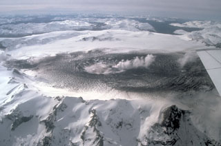
Geological Summary. The ice-filled, 10-km-wide caldera of Cerro Hudson volcano was not recognized until its first 20th-century eruption in 1971. It is the southernmost volcano in the Chilean Andes, related to subduction of the Nazca plate beneath the South American plate. The massive volcano covers an area of 300 km2. The compound caldera is drained through a breach on its NW rim, which has been the source of mudflows down the Río de Los Huemeles. Two cinder cones occur N of the volcano and others occupy the SW and SE flanks. This volcano has been the source of several major Holocene explosive eruptions. An eruption about 6,700 years ago was one of the largest known in the southern Andes during the Holocene; another eruption about 3,600 years ago also produced more than 10 km3 of tephra. An eruption in 1991 formed a new 800-m-wide crater in the SW portion of the caldera.
Sources: Oficina Nacional de Emergencia-Ministerio del Interior (ONEMI), Servicio Nacional de Geología y Minería (SERNAGEOMIN)