Report on Bardarbunga (Iceland) — 3 September-9 September 2014
Smithsonian Institution / US Geological Survey
Weekly Volcanic Activity Report, 3 September-9 September 2014
Managing Editor: Sally Sennert.
Please cite this report as:
Global Volcanism Program, 2014. Report on Bardarbunga (Iceland) (Sennert, S, ed.). Weekly Volcanic Activity Report, 3 September-9 September 2014. Smithsonian Institution and US Geological Survey.
Bardarbunga
Iceland
64.633°N, 17.516°W; summit elev. 2000 m
All times are local (unless otherwise noted)
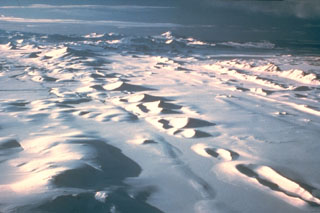
During 3-9 September the Icelandic Met Office reported ongoing lava effusion, high gas emissions, and elevated seismicity from Bárdarbunga’s Holuhraun lava field. On 3 September, the lava flow continued advancing ENE and covered 7.2 km2. Field observations determined that ash production was almost negligible. Radar images provided measurements of a 0.5-1 km wide depression that had formed within the Dyngjujökull glacier (located ~2 km S of the eruption site).
On 4 September there was no decline in effusive activity and the lava field had an aerial extent of 10.8 km2. There were no obvious changes on the Dyngjujökull glacier.
Two new eruptive fissures were observed south of the main eruption site on 5 September. These sites were less effusive and were located ~2 km away from the Dyngjujökull glacier. The eruption also continued from the original fissure and generated a ~460 m high steam plume. During a surveillance flight, the depression within Dyngjujökull glacier appeared to have grown deeper. On 6 September large changes were observed from the overlying glacier of Bárdarbunga (Vatnajökull glacier); a large area subsided that corresponded to deformation of the caldera floor. There were no signs of an eruption from the caldera. Two depressions were noted on the Dyngjujökull glacier, suggesting that small, short sub-glacial eruptions may have occurred.
The fissure eruption continued during 6-7 September and lava effusion was 100-200 m3/s on 7 September. Activity from the S fissures was less than that of the N fissure which had been active since the beginning of the eruption. The advancing lava flow reached the W main branch of the Jökulsá á Fjöllum river. No explosive activity due to lava and river water interaction was observed, but steam rose from the area.
During 8-9 September activity was no longer detected from the southernmost fissure. Lava continued to advance and interact with the Jökulsá á Fjöllum river. The extent of the lava flow reached 19 km2 and gas emissions remained high.
The London VAAC reported no ash plumes associated with the fissure eruptions. The Aviation Color Code remained at Orange.
Geological Summary. The large central volcano of Bárðarbunga lies beneath the NW part of the Vatnajökull icecap, NW of Grímsvötn volcano, and contains a subglacial 700-m-deep caldera. Related fissure systems include the Veidivötn and Trollagigar fissures, which extend about 100 km SW to near Torfajökull volcano and 50 km NE to near Askja volcano, respectively. Voluminous fissure eruptions, including one at Thjorsarhraun, which produced the largest known Holocene lava flow on Earth with a volume of more than 21 km3, have occurred throughout the Holocene into historical time from the Veidivötn fissure system. The last major eruption of Veidivötn, in 1477, also produced a large tephra deposit. The subglacial Loki-Fögrufjöll volcanic system to the SW is also part of the Bárðarbunga volcanic system and contains two subglacial ridges extending from the largely subglacial Hamarinn central volcano; the Loki ridge trends to the NE and the Fögrufjöll ridge to the SW. Jökulhlaups (glacier-outburst floods) from eruptions at Bárðarbunga potentially affect drainages in all directions.
Sources: Icelandic Meteorological Office (IMO), London Volcanic Ash Advisory Centre (VAAC)