Report on Heard (Australia) — 27 January-2 February 2016
Smithsonian Institution / US Geological Survey
Weekly Volcanic Activity Report, 27 January-2 February 2016
Managing Editor: Sally Sennert.
Please cite this report as:
Global Volcanism Program, 2016. Report on Heard (Australia) (Sennert, S, ed.). Weekly Volcanic Activity Report, 27 January-2 February 2016. Smithsonian Institution and US Geological Survey.
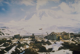
Heard
Australia
53.106°S, 73.513°E; summit elev. 2745 m
All times are local (unless otherwise noted)
Scientists and crew aboard CSIRO’s (Commonwealth Scientific and Industrial Research Organisation) Marine National Facility research vessel Investigator circled Heard Island and observed a plume rising from Mawson Peak’s crater and lava flows traveling down the NW flanks during 30-31 January. Visual observations of Heard are very rare due to its remote location. A MODVOLC thermal alert had been issued for 28 January.
Geological Summary. Heard Island on the Kerguelen Plateau in the southern Indian Ocean consists primarily of the emergent portion of two volcanic structures. The large glacier-covered composite basaltic-to-trachytic cone of Big Ben comprises most of the island, and the smaller Mt. Dixon lies at the NW tip of the island across a narrow isthmus. Little is known about the structure of Big Ben because of its extensive ice cover. The active Mawson Peak forms the island's high point and lies within a 5-6 km wide caldera breached to the SW side of Big Ben. Small satellitic scoria cones are mostly located on the northern coast. Several subglacial eruptions have been reported at this isolated volcano, but observations are infrequent and additional activity may have occurred.
Sources: Commonwealth Scientific and Industrial Research Organisation (CSIRO), NASA MODIS Rapid Response System