Report on Tangkuban Parahu (Indonesia) — 24 July-30 July 2019
Smithsonian Institution / US Geological Survey
Weekly Volcanic Activity Report, 24 July-30 July 2019
Managing Editor: Sally Sennert.
Please cite this report as:
Global Volcanism Program, 2019. Report on Tangkuban Parahu (Indonesia) (Sennert, S, ed.). Weekly Volcanic Activity Report, 24 July-30 July 2019. Smithsonian Institution and US Geological Survey.
Tangkuban Parahu
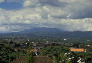
Indonesia
6.77°S, 107.6°E; summit elev. 2084 m
All times are local (unless otherwise noted)
PVMBG reported that a phreatic eruption at Tangkubanparahu's Ratu Crater began at 1548 on 26 July and was recorded in seismic data for about five minutes and 30 seconds. Dense blackish-gray, sediment-laden plumes rose around 200 m above the lake surface, and a lighter-colored component containing fine ash rose 600 m and spread NE and S. Tephra fell in a concentrated area within 500 m of the vent, creating deposits 5-7 cm thick. Visitors to the Kawasan Wisata Gunung Tangkuban Parahu tourist area that borders a section of the E and SE crater rim immediately evacuated. BNPB reported that the local government closed the tourist area noting that ash fell within a 1-2 km radius, in Jayagiri Village, Lembang District, and areas of the West Bandung Regency. Activity decreased after the eruption; tremor amplitude decreased during 27-28 July, and diffuse white plumes rose from the vent.
PVMBG noted that during the previous month white plumes of variable density rose as high as 150 m above the crater floor. Small local inflation was recorded, and deformation data continued to indicate instability at least through 27 July. Hydrogen sulfide and sulfur dioxide concentrations began to increase on 10 July and then significantly declined at 1200 on 13 July. Measurements on 21 July indicated that gas emissions continued to fluctuate but decreased overall. The Alert Level remained at 1 (on a scale of 1-4).
Geological Summary. Gunung Tangkuban Parahu is a broad stratovolcano overlooking Indonesia's former capital city of Bandung. The volcano was constructed within the 6 x 8 km Pleistocene Sunda caldera, which formed about 190,000 years ago. The volcano's low profile is the subject of legends referring to the mountain of the "upturned boat." The Sunda caldera rim forms a prominent ridge on the western side; elsewhere the rim is largely buried by deposits of the current volcano. The dominantly small phreatic eruptions recorded since the 19th century have originated from several nested craters within an elliptical 1 x 1.5 km summit depression.
Sources: Pusat Vulkanologi dan Mitigasi Bencana Geologi (PVMBG, also known as CVGHM), Badan Nacional Penanggulangan Bencana (BNPB)