Report on Helgrindur (Iceland) — 11 November-17 November 2020
Smithsonian Institution / US Geological Survey
Weekly Volcanic Activity Report, 11 November-17 November 2020
Managing Editor: Sally Sennert.
Please cite this report as:
Global Volcanism Program, 2020. Report on Helgrindur (Iceland) (Sennert, S, ed.). Weekly Volcanic Activity Report, 11 November-17 November 2020. Smithsonian Institution and US Geological Survey.
Helgrindur
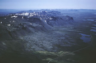
Iceland
64.866°N, 23.283°W; summit elev. 986 m
All times are local (unless otherwise noted)
IMO reported that the Alert Level for Helgrindur was raised from Gray (insufficient monitoring) to Green (normal, non-eruptive) on 12 November, reflecting the recent installation of three seismic stations along the peninsula. The new instruments will allow for better coverage and sensitivity for the detection of seismic unrest. The Alert Level scale consists of five colors.
Geological Summary. Helgrindur (also known as Lysuhóll or Lysukard) is one of Iceland's smallest volcanic systems. It consists of a chain of small alkali olivine basaltic cinder cones and vents along a WNW-ESE line cutting across the central Snaefellsnes Peninsula in western Iceland. The slightly arcuate line of Quaternary vents extends to the northern coast of the peninsula. Helgrindur is the central of three volcanic systems occupying the peninsula. The latest eruption is undated, but the system has been active during the Holocene.