Report on Soufriere St. Vincent (Saint Vincent and the Grenadines) — 13 January-19 January 2021
Smithsonian Institution / US Geological Survey
Weekly Volcanic Activity Report, 13 January-19 January 2021
Managing Editor: Sally Sennert.
Please cite this report as:
Global Volcanism Program, 2021. Report on Soufriere St. Vincent (Saint Vincent and the Grenadines) (Sennert, S, ed.). Weekly Volcanic Activity Report, 13 January-19 January 2021. Smithsonian Institution and US Geological Survey.
Soufriere St. Vincent
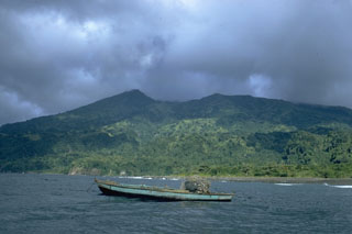
Saint Vincent and the Grenadines
13.33°N, 61.18°W; summit elev. 1220 m
All times are local (unless otherwise noted)
University of the West Indies Seismic Research Centre (UWI-SRC) and National Emergency Management Organisation (NEMO) reported that the lava dome in Soufrière St. Vincent’s main crater continued to grow during 13-19 January.
Observations on 14 January revealed that the dome was growing taller as well as expanding to the E and W. During an overflight on 15 January scientists saw extensive vegetation damage on the E, S, and W inner crater walls; damage previously noted along the upper part of the SW crater rim had expanded downslope. The dome dimensions were estimated to be 340 m long, 160 m wide, and 90 m high.
Scientists visited the dome on 16 January and collected rock samples from the W part of the dome. They recorded temperatures around 590 degrees Celsius from the expanding dome front. Gas emissions were most notable from a small circular depression at the top of the dome. At night during 15-17 January residents to the W saw incandescence emanating from the crater, a phenomenon likely to be more frequent as the dome grows higher. Gas emissions were visible in the afternoon of 17 January rising from the top of the dome as well as from areas of contact between the new and old domes. An area of burnt vegetation extended from the dome along the W part of the crater floor.
By the end of the week both new seismic and continuous GPS monitoring stations had been installed and were transmitting data, bring the total number of dedicated seismic stations to five. The Alert Level remained at Orange (the second highest level on a four-color scale).
Geological Summary. Soufrière St. Vincent is the northernmost and youngest volcano on St. Vincent Island. The NE rim of the 1.6-km wide summit crater is cut by a crater formed in 1812. The crater itself lies on the SW margin of a larger 2.2-km-wide caldera, which is breached widely to the SW as a result of slope failure. Frequent explosive eruptions after about 4,300 years ago produced pyroclastic deposits of the Yellow Tephra Formation, which cover much of the island. The first historical eruption took place in 1718; it and the 1812 eruption produced major explosions. Much of the northern end of the island was devastated by a major eruption in 1902 that coincided with the catastrophic Mont Pelée eruption on Martinique. A lava dome was emplaced in the summit crater in 1971 during a strictly effusive eruption, forming an island within a lake that filled the crater. A series of explosive eruptions in 1979 destroyed the 1971 dome and ejected the lake; a new dome was then built.
Sources: University of the West Indies Seismic Research Centre (UWI-SRC), National Emergency Management Organisation (NEMO), Government of Saint Vincent and the Grenadines