
Smithsonian Institution / US Geological Survey
Weekly Volcanic Activity Report, 12 September-18 September 2001
Managing Editor: Gari Mayberry
Please cite this report as:
Global Volcanism Program, 2001. Report on Kamaehuakanaloa (United States) (Mayberry, G, ed.). Weekly Volcanic Activity Report, 12 September-18 September 2001. Smithsonian Institution and US Geological Survey. https://volcano.si.edu/showreport.cfm?gvpvar=GVP.WVAR20010912-332000
An earthquake swarm occurred at Lōʻihi during 10-11 September and two 13 September earthquakes may have also been part of the swarm. The two later earthquakes occurred at 0311 and 0839 and had magnitudes of 4.9 and 4.4, respectively. Most of the earthquakes from 10-13 September were ~12 km deep and located slightly S of the summit of the volcano.
Source: US Geological Survey Hawaiian Volcano Observatory (HVO)
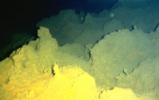
Geological Summary. The Kamaʻehuakanaloa seamount, previously known as Lōʻihi, lies about 35 km off the SE coast of the island of Hawaii. This youngest volcano of the Hawaiian chain has an elongated morphology dominated by two curving rift zones extending north and south of the summit. The summit region contains a caldera about 3 x 4 km and exhibits numerous lava cones, the highest of which is about 975 m below the ocean surface. The summit platform also includes two well-defined pit craters, sediment-free glassy lava, and low-temperature hydrothermal venting. An arcuate chain of small cones on the western edge of the summit extends north and south of the pit craters and merges into the crests prominent rift zones. Seismicity indicates a magmatic system distinct from that of Kīlauea. During 1996 a new pit crater formed at the summit, and lava flows were erupted. Continued volcanism is expected to eventually build a new island; time estimates for the summit to reach the ocean surface range from roughly 10,000 to 100,000 years.


 Kamaehuakanaloa