
Smithsonian Institution / US Geological Survey
Weekly Volcanic Activity Report, 13 November-19 November 2002
Managing Editor: Gari Mayberry
Please cite this report as:
Global Volcanism Program, 2002. Report on Papandayan (Indonesia) (Mayberry, G, ed.). Weekly Volcanic Activity Report, 13 November-19 November 2002. Smithsonian Institution and US Geological Survey. https://volcano.si.edu/showreport.cfm?gvpvar=GVP.WVAR20021113-263100
An eruption began at Papandayan on 11 November that led to the evacuation of thousands of residents near the volcano. Increased seismicity was first recorded in early October 2002 when deep volcanic earthquakes occurred. By mid-October, shallow volcanic earthquakes were recorded, which were indicative of earthquake migration towards the surface. These earthquakes continued until the day of the eruption. On 11 November felt earthquakes and tremor were recorded and at 1530 there was a phreatic eruption at Kawah Baru Crater. At 1650 landslides from the W wall of the old crater complex traveled to the river and became lahars. By the 14th the eruption had progressed into a phreatomagmatic or magmatic phase, and 17 eruptions had produced thick gray ash clouds 500-1,000 m above the volcano. Many people who did not live in the most dangerous areas were allowed to return to their homes on the 14th. A relatively large eruption on the 15th at 0630 generated an ash cloud that reached 5 km above the summit. At this point Papandayan was at Alert Level 4 (on a scale of 1-4). During 16-18 November, volcanism was dominated by ash emissions that rose to 700 m and seismicity was dominated by continuous emission and explosion earthquakes. On the 18th at 1200 the Alert Level at Papandayan was reduced to 3.
Sources: The Jakarta Post, Reuters, Pusat Vulkanologi dan Mitigasi Bencana Geologi (PVMBG, also known as CVGHM)
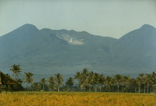
Geological Summary. Papandayan is a complex stratovolcano at the S end of a curved volcanic massif with Kendang volcano ~9 km away at the N end, Gunung Puntang ~3.5 km NNE, and Gunung Jaya ~6 km NNE. Several episodes of collapse have created an irregular profile and produced debris avalanches that have affected lowland areas. The summit area includes four large craters, including the 1.1-km-wide, flat-floored Alun-Alun crater. A sulfur-encrusted fumarole field occupies the active Kawah Mas ("Golden Crater"). The first reported eruption, in 1772 CE, included a collapse of the NE flank and a debris avalanche that destroyed 40 villages and killed almost 3,000 people. Smaller phreatic eruptions occurred during 1923-25, 1942, and 2002.


 Papandayan