
Smithsonian Institution / US Geological Survey
Weekly Volcanic Activity Report, 22 January-28 January 2003
Managing Editor: Gari Mayberry
Please cite this report as:
Global Volcanism Program, 2003. Report on Papandayan (Indonesia) (Mayberry, G, ed.). Weekly Volcanic Activity Report, 22 January-28 January 2003. Smithsonian Institution and US Geological Survey. https://volcano.si.edu/showreport.cfm?gvpvar=GVP.WVAR20030122-263100
On 13 January VSI decreased the Alert Level at Papandayan from 3 to 2 (on a scale of 1-4). Seismicity decreased during 13-19 January in comparison to the previous week, with ash emissions rising 25-100 m above the craters. Seismicity slightly increased during 20-26 January.
Source: Pusat Vulkanologi dan Mitigasi Bencana Geologi (PVMBG, also known as CVGHM)
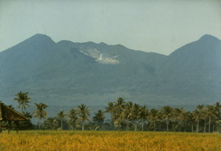
Geological Summary. Papandayan is a complex stratovolcano at the S end of a curved volcanic massif with Kendang volcano ~9 km away at the N end, Gunung Puntang ~3.5 km NNE, and Gunung Jaya ~6 km NNE. Several episodes of collapse have created an irregular profile and produced debris avalanches that have affected lowland areas. The summit area includes four large craters, including the 1.1-km-wide, flat-floored Alun-Alun crater. A sulfur-encrusted fumarole field occupies the active Kawah Mas ("Golden Crater"). The first reported eruption, in 1772 CE, included a collapse of the NE flank and a debris avalanche that destroyed 40 villages and killed almost 3,000 people. Smaller phreatic eruptions occurred during 1923-25, 1942, and 2002.


 Papandayan