
Smithsonian Institution / US Geological Survey
Weekly Volcanic Activity Report, 27 October-2 November 2004
Managing Editor: Gari Mayberry
Please cite this report as:
Global Volcanism Program, 2004. Report on Taal (Philippines) (Mayberry, G, ed.). Weekly Volcanic Activity Report, 27 October-2 November 2004. Smithsonian Institution and US Geological Survey. https://volcano.si.edu/showreport.cfm?gvpvar=GVP.WVAR20041027-273070
PHIVOLCS raised the Alert Level at Taal from 0 to 1 (on a scale of 0-5) on 29 October due to an increase in seismicity at the volcano. The seismic network at Taal began to record significant volcanic earthquakes on 23 September. In general, through 29 October the number of earthquakes increased, with a maximum of 13 earthquakes recorded on 15 October. Initial epicenter locations were in the vicinity of Main Crater and to the NNW near Binintiang Malaki and to the SSE near Calauit. No significant changes in thermal and steam emissions were observed. PHIVOLCS recommended appropriate vigilance by the public when visiting the island and noted that Main Crater was off-limits to visitors because of the potential for sudden steam explosions and high concentrations of noxious gases.
Source: Philippine Institute of Volcanology and Seismology (PHIVOLCS)
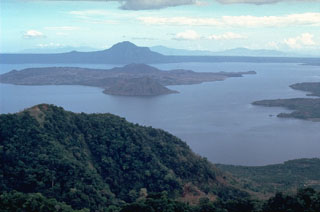
Geological Summary. Taal is one of the most active volcanoes in the Philippines and has produced some powerful eruptions. The 15 x 20 km Talisay (Taal) caldera is largely filled by Lake Taal, whose 267 km2 surface lies only 3 m above sea level. The maximum depth of the lake is 160 m, with several submerged eruptive centers. The 5-km-wide Volcano Island in north-central Lake Taal is the location of all observed eruptions. The island is composed of coalescing small stratovolcanoes, tuff rings, and scoria cones. Powerful pyroclastic flows and surges have caused many fatalities.


 Taal
Taal