
Smithsonian Institution / US Geological Survey
Weekly Volcanic Activity Report, 9 August-15 August 2017
Managing Editor: Sally Sennert
Please cite this report as:
Global Volcanism Program, 2017. Report on Piton de la Fournaise (France) (Sennert, S, ed.). Weekly Volcanic Activity Report, 9 August-15 August 2017. Smithsonian Institution and US Geological Survey. https://volcano.si.edu/showreport.cfm?gvpvar=GVP.WVAR20170809-233020
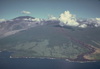
OVPF reported that the eruption at Piton de la Fournaise that began on 14 July continued through 15 August. Weather clouds often prevented visual confirmation of activity, though observers periodically noted that small amounts of material were ejected from a small vent on the N flank of the eruptive vent. Some active pāhoehoe flows were visible at a distance of 2 km from the cone, though most of the flow activity was confined to lava tubes.
Source: Observatoire Volcanologique du Piton de la Fournaise (OVPF)
Geological Summary. Piton de la Fournaise is a massive basaltic shield volcano on the French island of Réunion in the western Indian Ocean. Much of its more than 530,000-year history overlapped with eruptions of the deeply dissected Piton des Neiges shield volcano to the NW. Three scarps formed at about 250,000, 65,000, and less than 5,000 years ago by progressive eastward slumping, leaving large embayments open to the E and SE. Numerous pyroclastic cones are present on the floor of the scarps and their outer flanks. Most recorded eruptions have originated from the summit and flanks of Dolomieu, a 400-m-high lava shield that has grown within the youngest scarp, which is about 9 km wide and about 13 km from the western wall to the ocean on the E. More than 150 eruptions, most of which have produced fluid basaltic lava flows, have occurred since the 17th century. Eruptions in 1708, 1774, 1776, 1800, 1977, and 1986 originated from fissures outside the scarps.


 Piton de la Fournaise