
Smithsonian Institution / US Geological Survey
Weekly Volcanic Activity Report, 3 September-9 September 2008
Managing Editor: Sally Sennert
Please cite this report as:
Global Volcanism Program, 2008. Report on Ubinas (Peru) (Sennert, S, ed.). Weekly Volcanic Activity Report, 3 September-9 September 2008. Smithsonian Institution and US Geological Survey. https://volcano.si.edu/showreport.cfm?gvpvar=GVP.WVAR20080903-354020
Based on SIGMET reports and pilot observations, the Buenos Aires VAAC reported that during 5-6 September ash plumes from Ubinas rose to altitudes of 5.5-6.4 km (18,000-21,000 ft) a.s.l. and drifted NE and SE.
Source: Buenos Aires Volcanic Ash Advisory Center (VAAC)
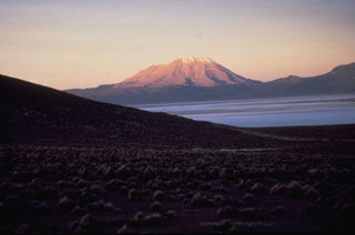
Geological Summary. The truncated appearance of Ubinas, Perú's most active volcano, is a result of a 1.4-km-wide crater at the summit. It is the northernmost of three young volcanoes located along a regional structural lineament about 50 km behind the main volcanic front. The growth and destruction of Ubinas I was followed by construction of Ubinas II beginning in the mid-Pleistocene. The upper slopes of the andesitic-to-rhyolitic Ubinas II stratovolcano are composed primarily of andesitic and trachyandesitic lava flows and steepen to nearly 45°. The steep-walled, 150-m-deep summit crater contains an ash cone with a 500-m-wide funnel-shaped vent that is 200 m deep. Debris-avalanche deposits from the collapse of the SE flank about 3,700 years ago extend 10 km from the volcano. Widespread Plinian pumice-fall deposits include one from about 1,000 years ago. Holocene lava flows are visible on the flanks, but activity documented since the 16th century has consisted of intermittent minor-to-moderate explosive eruptions.


 Ubinas