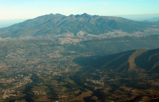
Report on Guagua Pichincha (Ecuador) — 18 February-24 February 2009
Smithsonian Institution / US Geological Survey
Weekly Volcanic Activity Report, 18 February-24 February 2009
Managing Editor: Sally Sennert.
Please cite this report as:
Global Volcanism Program, 2009. Report on Guagua Pichincha (Ecuador) (Sennert, S, ed.). Weekly Volcanic Activity Report, 18 February-24 February 2009. Smithsonian Institution and US Geological Survey.
Guagua Pichincha
Ecuador
0.171°S, 78.598°W; summit elev. 4784 m
All times are local (unless otherwise noted)
The IG reported four moderate phreatic explosions from Guagua Pichincha were detected by the seismic network during 16-17 February, following a few days of slightly increased seismicity and rainfall. IG recommended that visitors stay out of the caldera.
Geological Summary. Guagua Pichincha and the older Pleistocene Rucu Pichincha stratovolcanoes form a broad volcanic massif that rises immediately W of Ecuador's capital city, Quito. A lava dome grew at the head of a 6-km-wide scarp formed during a late-Pleistocene slope failure ~50,000 years ago. Subsequent late-Pleistocene and Holocene eruptions from the central vent consisted of explosive activity with pyroclastic flows accompanied by periodic growth and destruction of the lava dome. Many minor eruptions have been recorded since the mid-1500's; the largest took place in 1660, when ash fell over a 1,000 km radius and accumulated to 30 cm depth in Quito. Pyroclastic flows and surges also occurred, primarily to then W, and affected agricultural activity.
Source: Instituto Geofísico-Escuela Politécnica Nacional (IG-EPN)

