Report on Lewotobi (Indonesia) — 1 October-7 October 2014
Smithsonian Institution / US Geological Survey
Weekly Volcanic Activity Report, 1 October-7 October 2014
Managing Editor: Sally Sennert.
Please cite this report as:
Global Volcanism Program, 2014. Report on Lewotobi (Indonesia) (Sennert, S, ed.). Weekly Volcanic Activity Report, 1 October-7 October 2014. Smithsonian Institution and US Geological Survey.
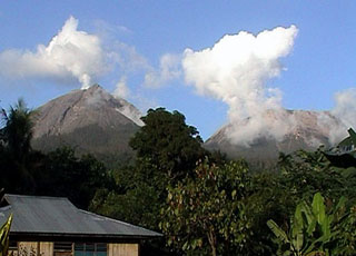
Lewotobi
Indonesia
8.542°S, 122.775°E; summit elev. 1703 m
All times are local (unless otherwise noted)
Based on analysis of satellite images and wind data, the Darwin VAAC reported that on 6 October a narrow, low-level ash plume from Lewotobi rose to an altitude of 3 km (10,000 ft) a.s.l. and drifted 185 km WNW.
Geological Summary. The Lewotobi edifice in eastern Flores Island is composed of the two adjacent Lewotobi Laki-laki and Lewotobi Perempuan stratovolcanoes (the "husband and wife"). Their summits are less than 2 km apart along a NW-SE line. The conical Laki-laki to the NW has been frequently active during the 19th and 20th centuries, while the taller and broader Perempuan has had observed eruptions in 1921 and 1935. Small lava domes have grown during the 20th century in both of the summit craters, which are open to the north. A prominent cone, Iliwokar, occurs on the E flank of Perampuan.