
Smithsonian Institution / US Geological Survey
Weekly Volcanic Activity Report, 21 January-27 January 2015
Managing Editor: Sally Sennert
Please cite this report as:
Global Volcanism Program, 2015. Report on Sinarka (Russia) (Sennert, S, ed.). Weekly Volcanic Activity Report, 21 January-27 January 2015. Smithsonian Institution and US Geological Survey. https://volcano.si.edu/showreport.cfm?gvpvar=GVP.WVAR20150121-290290
SVERT reported that activity at Sinarka was not detected during January; on 26 January the Aviation Color Code was lowered to Green.
Source: Sakhalin Volcanic Eruption Response Team (SVERT)
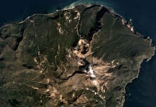
Geological Summary. Sinarka volcano, occupying the northern end of Shiashkotan Island in the central Kuriles, has a complex structure. A small, 2-km-wide depression open to the NW has been largely filled and overtopped by an andesitic postglacial central cone that itself contains a lava dome that forms the high point of the island. Another lava dome, Zheltokamennaya Mountain, lies 1.5 km to the SW along the buried SW rim of the caldera, and a smaller dome lies along the northern caldera rim. Historical eruptions have occurred during the 17th and 18th centuries. The last and largest of these, during 1872-78, was once thought to originate from Kuntomintar volcano at the southern end of the island, but is now attributed to Sinarka (Gorshkov, 1970).


 Sinarka