Report on Talang (Indonesia) — 18 March-24 March 2015
Smithsonian Institution / US Geological Survey
Weekly Volcanic Activity Report, 18 March-24 March 2015
Managing Editor: Sally Sennert.
Please cite this report as:
Global Volcanism Program, 2015. Report on Talang (Indonesia) (Sennert, S, ed.). Weekly Volcanic Activity Report, 18 March-24 March 2015. Smithsonian Institution and US Geological Survey.
Talang
Indonesia
0.979°S, 100.681°E; summit elev. 2575 m
All times are local (unless otherwise noted)
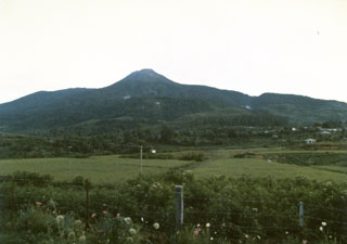
PVMBG reported that during 1 January-18 March diffuse white plumes rose at most 200 m above Talang’s Gabuo, Utama, Selatan, and Kapundan Panjang craters. Seismicity was low, no deformation was detected, and water temperatures had not significantly changed. On 20 March the Alert Level was lowered to 1 (on a scale of 1-4). Visitors and tourists were warned to stay away from the craters.
Geological Summary. Talang is part of a large volcanic edifice just NW of Dibawah Lake. An older volcanic peak, Pasar Arbaao, is ~1.5 km W. The steep-sided Talang cone exhibits fumarolic activity but has no crater; it appears to have grown within a larger caldera. Recorded eruptions have mostly involved small-to-moderate explosive activity, first documented in the 19th century, that originated from a series of small craters in a valley on the NE flank.
Source: Pusat Vulkanologi dan Mitigasi Bencana Geologi (PVMBG, also known as CVGHM)