Report on Nishinoshima (Japan) — 24 August-30 August 2016
Smithsonian Institution / US Geological Survey
Weekly Volcanic Activity Report, 24 August-30 August 2016
Managing Editor: Sally Sennert.
Please cite this report as:
Global Volcanism Program, 2016. Report on Nishinoshima (Japan) (Sennert, S, ed.). Weekly Volcanic Activity Report, 24 August-30 August 2016. Smithsonian Institution and US Geological Survey.
Nishinoshima
Japan
27.247°N, 140.874°E; summit elev. 100 m
All times are local (unless otherwise noted)
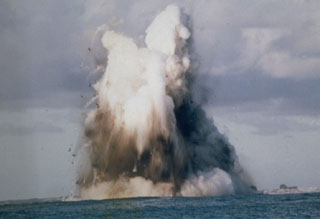
JMA reported that no additional activity was observed after the 17 November 2015 eruption at Nishinoshima, which ejected bombs a few meters in diameter as far as 1 km from the vent, suggesting the eruption had stopped sometime in late November. Gas emissions decreased in June 2016. High-temperature areas around the crater continued to be detected. JMA reduced the warning statement for the island, specifying hazards were less severe “around the crater” (encompassing areas within 500 m), rather than more broadly “near the crater”.
Geological Summary. The small island of Nishinoshima was enlarged when several new islands coalesced during an eruption in 1973-74. Multiple eruptions that began in 2013 completely covered the previous exposed surface and continued to enlarge the island. The island is the summit of a massive submarine volcano that has prominent peaks to the S, W, and NE. The summit of the southern cone rises to within 214 m of the ocean surface 9 km SSE.

