
Smithsonian Institution / US Geological Survey
Weekly Volcanic Activity Report, 27 December-2 January 2018
Managing Editor: Sally Sennert
Please cite this report as:
Global Volcanism Program, 2017. Report on Kanlaon (Philippines) (Sennert, S, ed.). Weekly Volcanic Activity Report, 27 December-2 January 2018. Smithsonian Institution and US Geological Survey. https://volcano.si.edu/showreport.cfm?gvpvar=GVP.WVAR20171227-272020
PHIVOLCS reported that there were three or fewer volcanic earthquakes detected at Kanlaon each day during 27 December 2017-2 January 2018. Dense weather clouds prevented visual observations, though on 30 December a steam plume was seen rising 500 m above the crater rim and drifting SW. The Alert Level remained at 2 (on a scale of 0-5).
Source: Philippine Institute of Volcanology and Seismology (PHIVOLCS)
Geological Summary. Kanlaon volcano (also spelled Canlaon) forms the highest point on the Philippine island of Negros. The massive andesitic stratovolcano is covered with fissure-controlled pyroclastic cones and craters, many of which are filled by lakes. The largest debris avalanche known in the Philippines traveled 33 km SW from Kanlaon. The summit contains a 2-km-wide, elongated northern caldera with a crater lake and a smaller but higher active vent, Lugud crater, to the south. Eruptions recorded since 1866 have typically consisted of phreatic explosions of small-to-moderate size that produce minor local ashfall.


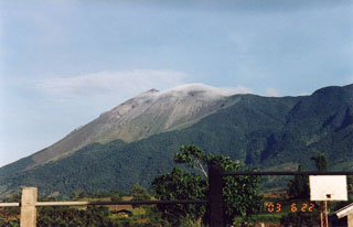 Kanlaon