
Smithsonian Institution / US Geological Survey
Weekly Volcanic Activity Report, 14 November-20 November 2018
Managing Editor: Sally Sennert
Please cite this report as:
Global Volcanism Program, 2018. Report on Merapi (Indonesia) (Sennert, S, ed.). Weekly Volcanic Activity Report, 14 November-20 November 2018. Smithsonian Institution and US Geological Survey. https://volcano.si.edu/showreport.cfm?gvpvar=GVP.WVAR20181114-263250
PVMBG reported that during 9-15 November the lava dome in Merapi’s summit crater grew at a rate of 2,400 cubic meters per day, slower than the previous week. By 14 November the volume of the dome, based on photos from the SE sector, was an estimated 290,000 cubic meters. White emissions of variable density rose a maximum of 200 m above the summit. The Alert Level remained at 2 (on a scale of 1-4), and residents were warned to remain outside of the 3-km exclusion zone.
Source: Pusat Vulkanologi dan Mitigasi Bencana Geologi (PVMBG, also known as CVGHM)
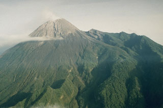
Geological Summary. Merapi, one of Indonesia's most active volcanoes, lies in one of the world's most densely populated areas and dominates the landscape immediately north of the major city of Yogyakarta. It is the youngest and southernmost of a volcanic chain extending NNW to Ungaran volcano. Growth of Old Merapi during the Pleistocene ended with major edifice collapse perhaps about 2,000 years ago, leaving a large arcuate scarp cutting the eroded older Batulawang volcano. Subsequent growth of the steep-sided Young Merapi edifice, its upper part unvegetated due to frequent activity, began SW of the earlier collapse scarp. Pyroclastic flows and lahars accompanying growth and collapse of the steep-sided active summit lava dome have devastated cultivated lands on the western-to-southern flanks and caused many fatalities.


 Merapi