
Smithsonian Institution / US Geological Survey
Weekly Volcanic Activity Report, 5 February-11 February 2026
Managing Editor: Sally Sennert
Please cite this report as:
Global Volcanism Program, 2026. Report on Mayon (Philippines) (Sennert, S, ed.). Weekly Volcanic Activity Report, 5 February-11 February 2026. Smithsonian Institution and US Geological Survey. https://volcano.si.edu/showreport.cfm?gvpvar=GVP.WVAR20260205-273030
The Philippine Institute of Volcanology and Seismology (PHIVOLCS) reported that the eruption at Mayon continued during 5-11 February, characterized by effusion and collapses at the summit dome, larger pyroclastic density currents (PDCs), increasing numbers of incandescent rockfalls, ash plumes, and active lava flows. Moderate emissions rose as high as 1 km above the summit and drifted in various directions during 4-10 February; weather clouds obscured views on the other days. The seismic network recorded 335-469 daily rockfall events and 6-52 daily PDCs. There were 0-8 daily volcanic earthquakes recorded by the seismic network. Sulfur dioxide emissions averaged 1,799 tonnes per day (t/d) on 5 and 7 February and 3,749 t/d on 10 February. Lava flows were active in three main drainages, though activity impacted minor drainages as well. By 8 February lava flows had advanced to radial distances of 1.3 km, 1.6 km and 3.8 km on the Mi-isi (S), Bonga (SE), and Basud (E) drainages, respectively.
Activity increased during 9-10 February. Rockfall totals peaked at 469 on 9 February and the largest PDC events occurred the next day. Three major PDC events occurred during 0230-0244 on 10 February, though weather clouds obscured visual observations. Ashfall occurred in Tumpa (7 km SW), Guinobatan, Albay. A series of at least 12 successive major PDC events occurred during 1035-1137; the largest event was recorded at 1059 and lasted seven minutes based on seismic data. The event at 1059 and subsequent major PDCs traveled as far as 4 km down the Mi-isi drainage, the farthest PDC run-out distances so far during the current eruption. Weather conditions again obscured views, though prominent brownish to grayish ash clouds were visible rising more than 2 km above the summit and drifting W and SW. Variable amounts of ashfall, that was sometimes wet, fell in the barangays (neighborhoods) of Sua (6 km SSW), Tumpa, Quirangay (6 km SSW), Ligban (11 km SSW), Bariw (12 km SW), Anoling (5 km SSW), Cabangan (9 km S), Barangays 1-7, Sumlang (9 km S), Libod (10 km SW), Salugan (8 km SSW), and Gapo (9 km S) in Camalig, Albay, and in Travesia (11 km SW), Maninila (8 km SW), Ilawod (10 km SW), Lower Binogsacan (13 km WSW), Quibongbongan (14 km SW), San Rafael (11 km SW), Sinungtan (21 km SW), Quitago (13 km SW), Inamnan Pequeño (12 km SW), Doña Mercedes (17 km SW), Poblacion (12 km SW), Tandarora (9 km SW), and Masarawag (5 km W), Guinobatan, Albay.
PHIVOLCS noted that the increase in rockfalls and PDCs was likely triggered by increased effusion of lava directed towards the Mi-isi lava flow. The PDCs were produced by collapses in the crater area, including collapses of relatively larger volumes of pre-erupted, oxidized, and degassed lava that contributed brownish ash in the PDC ash clouds.
By 1800 on 10 February a total of 4,057 people (1,115 families) were staying in 13 evacuation shelters, and an additional 53 people (17 families) were staying with friends or relatives, according to the Disaster Response Operations Monitoring and Information Center (DROMIC). According to a news report some schools in Camalig town suspended classes during 10-11 February due to ashfall. The Alert Level remained at 3 (on a 0-5 scale) and residents were reminded to stay away from the 6-km-radius Permanent Danger Zone (PDZ). PHIVOLCS recommended that civil aviation authorities advise pilots to avoid flying close to the summit.
Sources: Philippine Institute of Volcanology and Seismology (PHIVOLCS), Disaster Response Operations Monitoring and Information Center (DROMIC), Inquirer.net
Geological Summary. Symmetrical Mayon, which rises above the Albay Gulf NW of Legazpi City, is the most active volcano of the Philippines. The steep upper slopes are capped by a small summit crater. Recorded eruptions since 1616 CE range from Strombolian to basaltic Plinian, with cyclical activity beginning with basaltic eruptions, followed by longer periods of andesitic lava flows. Eruptions occur predominately from the central conduit and have also produced lava flows that travel far down the flanks. Pyroclastic density currents and mudflows have commonly swept down many of the approximately 40 ravines that radiate from the summit and have often damaged populated lowland areas. A violent eruption in 1814 killed more than 1,200 people and devastated several towns.


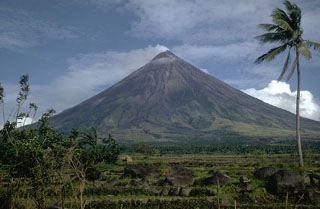 Mayon
Mayon