
Smithsonian Institution
Bulletin of the Global Volcanism Network, vol. 41, no. 9 (September 2016)
Managing Editor: Edward Venzke
Research and preparation by Paul Berger
Lewotolok (Indonesia) Thermal hotspots during 27 September-4 October 2015
Please cite this report as:
Global Volcanism Program, 2016. Report on Lewotolok (Indonesia) (Venzke, E, ed.). Bulletin of the Global Volcanism Network, 41:9. Smithsonian Institution. https://doi.org/10.5479/si.GVP.BGVN201609-264230
During December 2011-January 2012, Lewotolo's seismic activity increased and the volcano produced thick, white plumes that rose as high as 250 m above the summit before subsiding (BGVN 36:12). Since that episode, no further activity was observed through 31 December 2016, except for several thermal anomalies during 27 September 2015-4 October 2015, as recorded by MODIS satellite instruments analyzed using the MODVOLC algorithm (figure 2).
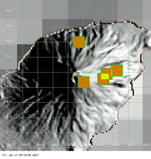 |
Figure 2. The MODIS/MODVOLC composite image that indicates the location of thermal anomalies at Lewotolo between 27 September and 4 October 2015. One is N of the summit (27 September), the others are somewhat E. One of the two hotspots on 4 October appears on the E summit rim. The daily thermal alert maps indicated that the five hotspots were all weak. |
Information Contacts: Hawai'i Institute of Geophysics and Planetology (HIGP), MODVOLC Thermal Alerts System, School of Ocean and Earth Science and Technology (SOEST), Univ. of Hawai'i, 2525 Correa Road, Honolulu, HI 96822, USA (URL: http://modis.higp.hawaii.edu/, http://modis.higp.hawaii.edu/).
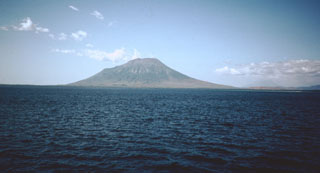
Geological Summary. The Lewotolok (or Lewotolo) stratovolcano occupies the eastern end of an elongated peninsula extending north into the Flores Sea, connected to Lembata (formerly Lomblen) Island by a narrow isthmus. It is symmetrical when viewed from the north and east. A small cone with a 130-m-wide crater constructed at the SE side of a larger crater forms the volcano's high point. Many lava flows have reached the coastline. Eruptions recorded since 1660 have consisted of explosive activity from the summit crater.


 Lewotolok