
Smithsonian Institution / US Geological Survey
Weekly Volcanic Activity Report, 21 March-27 March 2007
Managing Editor: Sally Sennert
Please cite this report as:
Global Volcanism Program, 2007. Report on Batu Tara (Indonesia) (Sennert, S, ed.). Weekly Volcanic Activity Report, 21 March-27 March 2007. Smithsonian Institution and US Geological Survey. https://volcano.si.edu/showreport.cfm?gvpvar=GVP.WVAR20070321-264260
Based on reports from fishermen and people in coastal communities about 50 km away, CVGHM reported that eruption plumes from Batu Tara rose to altitudes of 1.2-2.2 km (3,900-7,200 ft) a.s.l. and drifted E during 18-19 March. In response, the Alert Level was raised from 1 to 2 (on a scale of 1-4). Based on information from CVGHM and satellite imagery, the Darwin VAAC reported that continuous diffuse plumes rose to 1.5 km (5,000 ft) a.s.l. and drifted mainly SE during 21-27 March.
Sources: Pusat Vulkanologi dan Mitigasi Bencana Geologi (PVMBG, also known as CVGHM), Darwin Volcanic Ash Advisory Centre (VAAC)
Geological Summary. The small isolated island of Batu Tara is located in the Flores Sea ~50 km N of Lembata (formerly Lomblen) Island and the main volcanic arc. A scarp on the eastern side reaches the sea, and vegetation covers the other flanks to within 50 m of the summit. This volcano is noted for its potassic leucite-bearing basanitic and tephritic rocks. The first recorded eruption, during 1847-52, produced explosions and a lava flow.


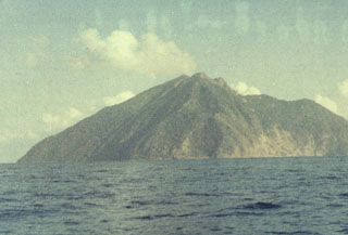 Batu Tara